GEMStat
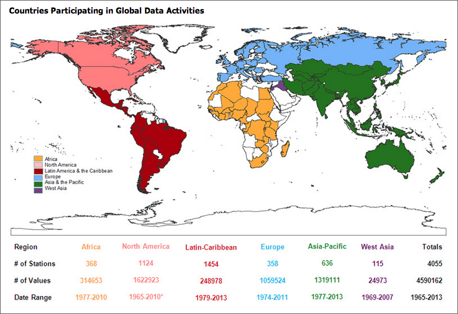
GEMStat is designed to share surface and groundwater quality data sets collected from the GEMS/Water Global Network, including more than 3,700 stations, close to 4.3 million records, and over 100 parameters.
The United Nations Global Environment Monitoring System (GEMS) Water Programme is dedicated to providing environmental water quality data and information of the highest integrity, accessibility and interoperability. These data are used in water assessments and capacity building initiatives around the world.
Display them on-the-fly as maps, graphs, data tables (available in the future) or download the data in different formats (available in the future).
Contents
Search for Data
To get started, searching for water quality data is possible for your region and there is a checkbox form to help search for certain parameters you are looking for (e.g. iron, ammonia, fluoride, etc.) GEMStat has stations all over the world, so you can find one near you.
| Search for Data |
View in Google Earth
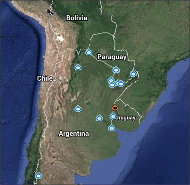
KMZ files containing GEMS/Water stations for individual countries and for the world are available for download and display in Google Earth. You will find links to these files on those Search for Data web pages that display a map of a country and its stations.
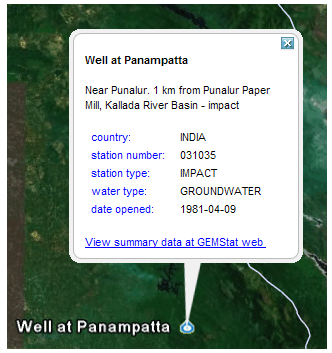
If you view the water points in Google Earth, you will see more information about each station. There are also photos that accompany many of the stations to show the region you are looking at. There are instructions in the link below to download Google Earth software, if you do not already have it installed on your computer. Basically once you download the KMZ files (available after you search in the search for data link on the GEMStat site) then you simply open the KMZ file and it automatically opens in Google Earth and shows you the region.
| Viewing GEMS/Water Stations in Google Earth™ |
How to participate in the GEMS/Water network
Any country in the world is encouraged to participate in the water quality sampling and post it to the database. Instructions for how to do this are in these PDFs:
Data Form
English - GEMS Op Guide Data Submission Form
French - GEMS Op Guide Data Submission Form
Station Form
English - GEMS Op Guide Station Submission Form
French - GEMS Op Guide Station Submission Form
For guidance on how to design a water quality monitoring program that addresses design, requirements and desired outcomes including recommended sampling sites, monitoring variables, sampling frequencies, operational requirements, data and a quality assurance strategy, refer to the report UNEP GEMS/Water Programme: South Africa Monitoring Program Design.


